Information for "A466"
From Tardis Wiki, the free Doctor Who reference
| Display title | A466 |
| Default sort key | A466 |
| Page length (in bytes) | 892 |
| Page ID | 266092 |
| Page content language | en - English |
| Page content model | wikitext |
| Indexing by robots | Allowed |
| Number of redirects to this page | 0 |
| Counted as a content page | Yes |
| Number of subpages of this page | 0 (0 redirects; 0 non-redirects) |
| Page image |  |
| Edit | Allow all users (infinite) |
| Move | Allow all users (infinite) |
View the protection log for this page.
| Page creator | 66 Seconds (talk | contribs) |
| Date of page creation | 00:41, 9 February 2020 |
| Latest editor | MrThermomanPreacher (talk | contribs) |
| Date of latest edit | 00:34, 8 February 2023 |
| Total number of edits | 6 |
| Total number of distinct authors | 3 |
| Recent number of edits (within past 90 days) | 0 |
| Recent number of distinct authors | 0 |
| Transcluded templates (2) | Templates used on this page:
|
Description | Content |
Article description: (description)
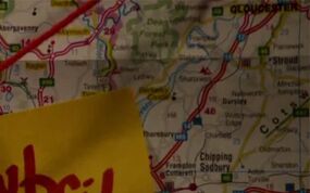
This attribute controls the content of the description and og:description elements. | The A466 was a road in the south-east of Wales and the west of England. At least in part, it roughly followed the Welsh border with England, as well as the River Wye. |
Information from
Extension:WikiSEO

